Assessing the effects of management and environmental change on Hatteras Island
Photos © Hannah Henry, CECL
The goal of this project is to co-produce science-based assessments of future landscape change under different management and sea-level rise scenarios to provide insight in support of decision-making processes. Our project team includes representatives from Dare County, the North Carolina Department of Transportation (NCDOT) Ferry Division, NCDOT Highway Division, and other stakeholders in the region. (Funded by NC Sea Grant)
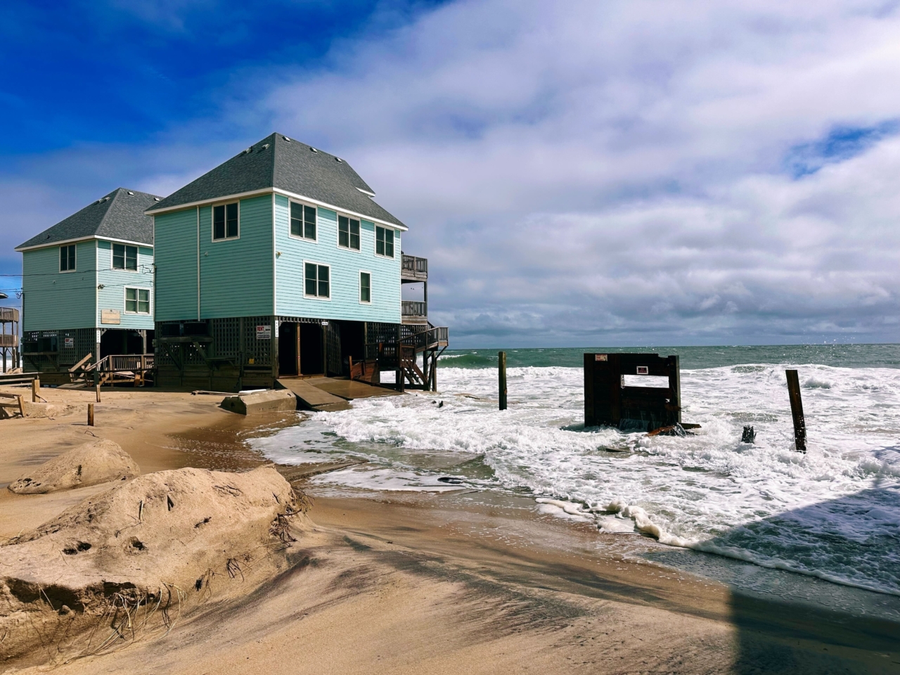
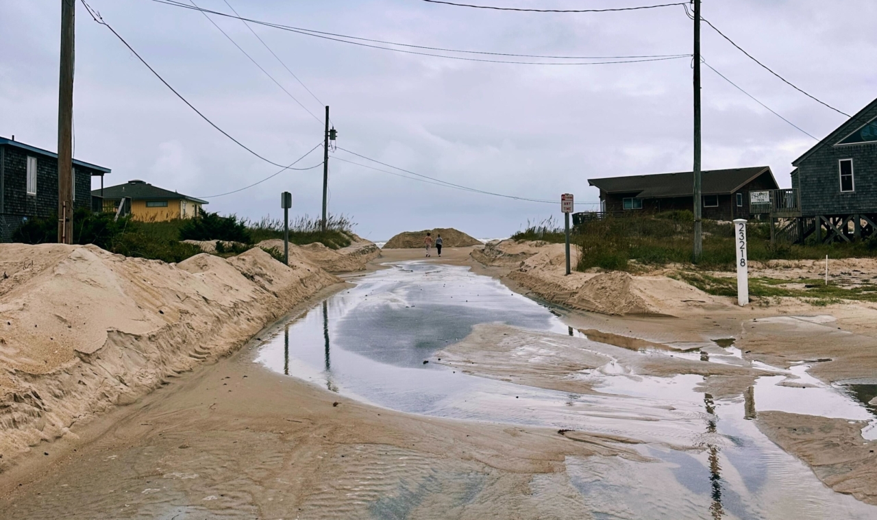
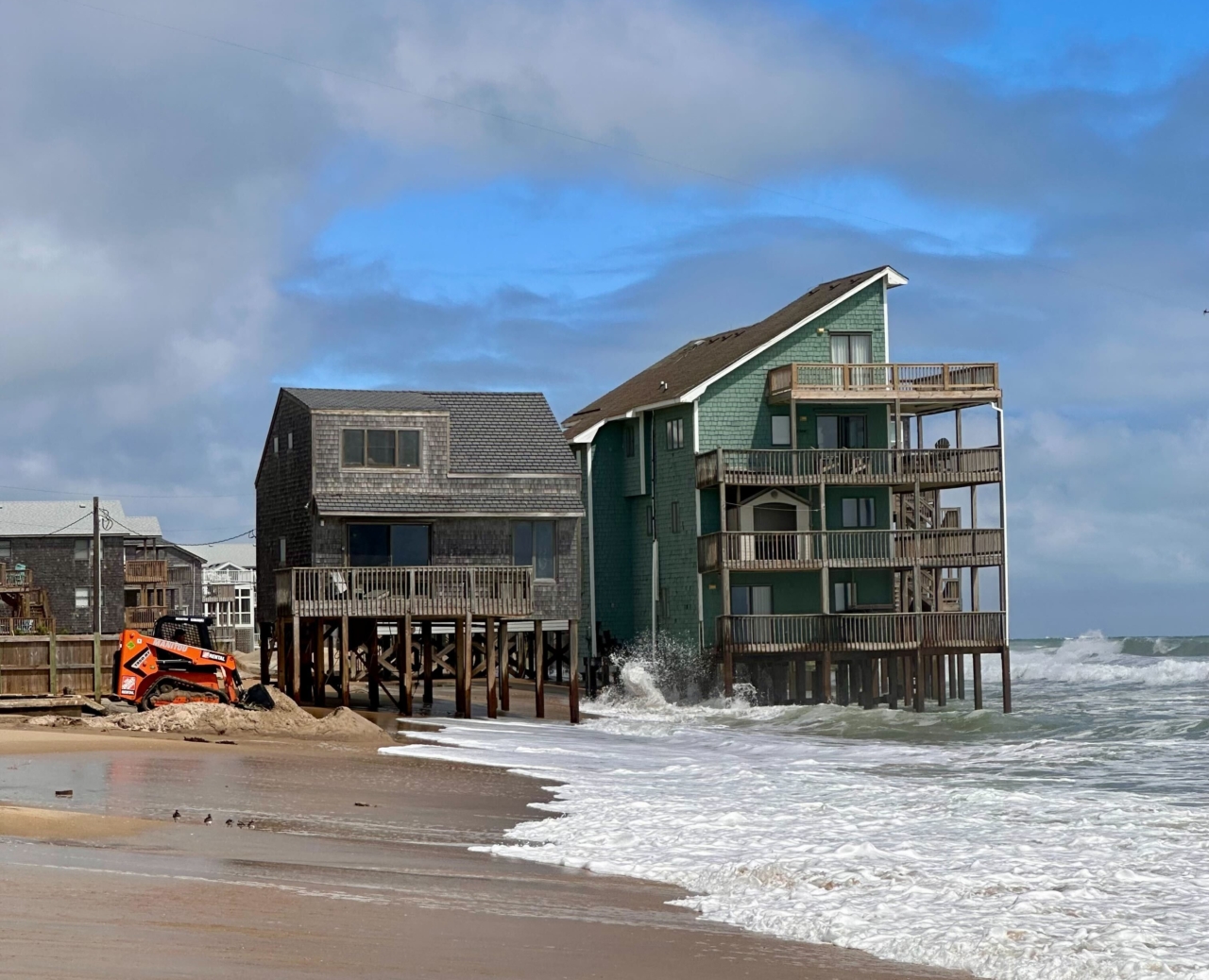
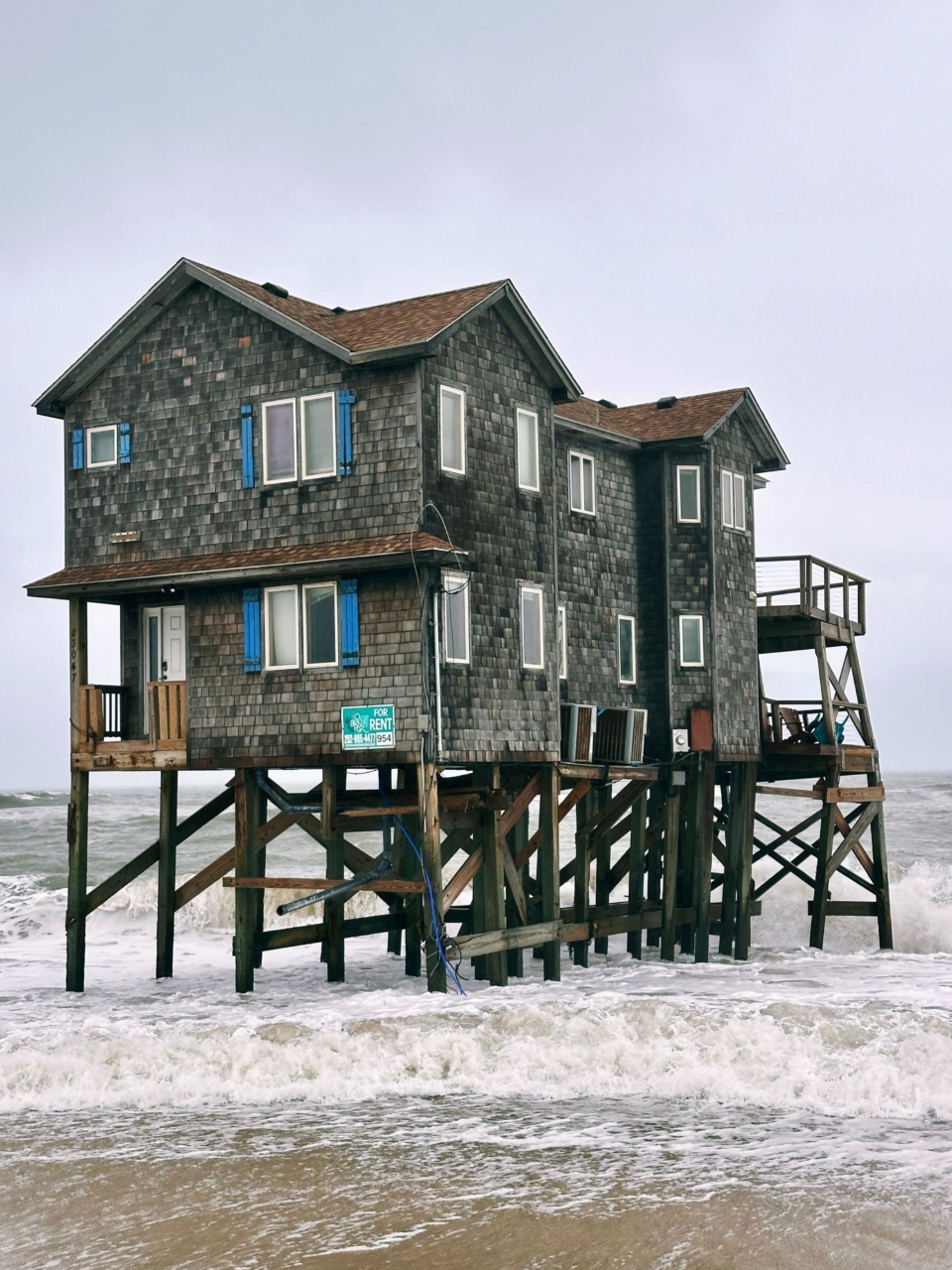
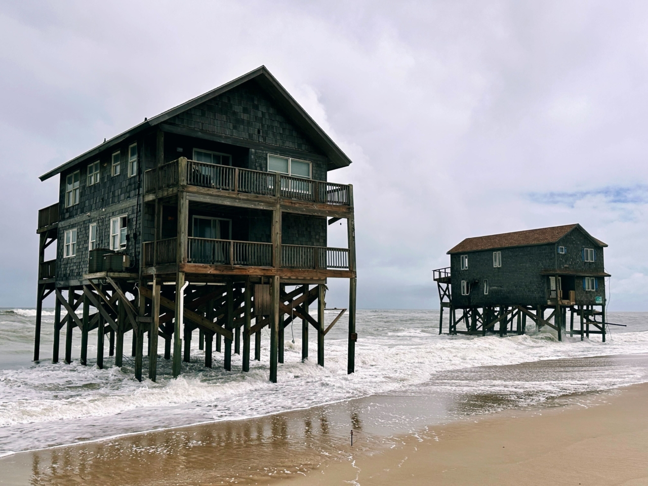
On October 1st, six homes in the Buxton community of Hatteras Island collapsed within 24 hours as hurricanes Humberto and Imelda passed offshore. More homes were lost in the following weeks following the loss of multiple Even storms that remain offshore produce strong winds and large waves, compounding long-term coastal erosion in the region. Over the past five years, 19 homes have collapsed, highlighting the need to assess future risks, community impacts, and management strategies.
Barrier islands are vital coastal ecosystems that also buffer the North Carolina mainland from storms, erosion, and flooding. Hatteras Island, NC is a 42-mile-long barrier island, which is home to the communities of Rodanthe, Waves, Salvo, Avon, Buxton, Frisco, and Hatteras Village and draws millions of tourists annually to visit the Cape Hatteras National Seashore. However, the dynamic nature of barrier island evolution and the processes that sustain them create complex coastal management challenges. Communities on Hatteras face infrastructure vulnerability and rising costs for management actions like beach nourishment; impacts that will likely become more severe as sea level rises and intense hurricanes occur more frequently in the future.
The communities of Hatteras Island and associated stakeholder groups are urgently seeking to address threatened oceanfront structures in the face of rapid, chronic erosion that has brought the shoreline farther landward over time. A range of management strategies are under consideration, including beach nourishment and groin reconstruction. Understanding how different management actions affect future island characteristics and infrastructure vulnerability, is essential to assessing the tradeoffs involved in different choices. This is especially important because some management strategies, although beneficial in the short-term (years), can be counterproductive, unintentionally leading to lower island elevations and narrower island widths, thereby reducing island habitability in the longer term (decades).
This project is a collaborative effort to evaluate the likely future effects of different management strategies on island width, elevation, position and habitability under different future sea level rise scenarios. By working with project partners—including the National Park Service, Dare County, the North Carolina Department of Transportation and other stakeholders, scientists from the University of North Carolina at Chapel Hill, North Carolina State University, Duke University, and the Water Institute will generate model outcomes to support discussions of management choices, while also advancing our understanding of how human and natural processes interact to shape barrier island futures.
Homes in the surf zone in Buxton, NC, Fall 2025. Photos © Hannah Henry, CECL
Become a participant by joining the C-CoAST Network.

